
Surprising Facts: Houston Public Transportation in Numbers
Did you know Houston’s METRO system moves over 200,000 riders daily, though the city ranks among the most car-dependent in America?
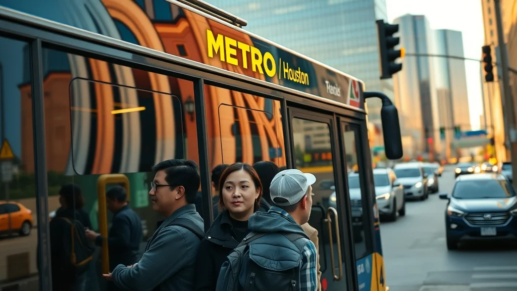
Houston public transportation offers a surprising level of reach, especially in a city famed for its car culture. According to METRO (Metropolitan Transit Authority of Harris County), more than 200,000 riders rely daily on METRO’s network, which comprises over 1,200 buses, three METRORail lines, and multiple suburban Park & Ride lots connecting outlying areas to downtown Houston. The service area extends across greater Houston, making it more ambitious than many realize. Significant investments—such as the multi-billion bond passed in recent years—indicate that Houston is serious about upgrading its public transit system for a growing, dynamic metropolis.
Despite strong numbers, Houston remains among America’s most car-dependent cities, with only about 4–5% of commuters using public transportation for their daily trips, compared to cities like Los Angeles or New York, where that rate is around 30–60%. Yet, every aspect of Houston public transportation—from its Park & Ride commuter buses out of NRG Park to the growing light rail lines—reinforces the city’s effort to remain connected, resilient, and future-focused.
What You'll Learn About Houston Public Transportation
An overview of Houston public transportation options
Key stations and transit centers for easy commuting
Payment methods for Houston public transportation
Opinions on service reliability and city connectivity
Future trends and innovations in Houston public transportation
Houston Public Transportation Overview: Is It Right for Houstonians?
Current State of Houston Public Transportation
Houston’s public transportation has evolved into a vital backbone for the city of Houston, catering to both daily commuters and occasional travelers. The bus system, operated by METRO, is robust, offering an extensive network of local bus and express services linking suburbs and neighborhoods to major destinations like University of Houston, Hobby Airport, NRG Park, and the Theater District. Complementing the extensive bus network are three METRORail lines (Red, Purple, and Green), which provide fast, frequent connections through core corridors such as downtown, Midtown, and the Texas Medical Center.
Recent expansions in bus rapid transit and park & ride options have broadened access to the transit system. Today, residents living in suburbs can tap into park & ride lots and take advantage of dedicated bus lanes to speed up their commute, bypassing freeway congestion. Despite these major upgrades, use of Houston public transportation still lags behind peer cities—likely due to Houston’s sprawling layout and car-centric infrastructure. But METRO’s ongoing improvements and outreach are changing perceptions, inviting more Houstonians to reconsider how they move through their city.
How Houston’s public transit compares to other major cities
When compared to other U.S. metropolitan giants, Houston’s public transit stands at a crossroads. While regional leaders like Los Angeles and San Francisco boast sprawling subway and light rail systems, Houston’s strength lies in its flexible bus route network and targeted rapid transit initiatives. The city’s bus rapid transit—with features like traffic-light priority and limited stops—acts as a bridge toward efficient, high-capacity travel.
However, Houston’s rail system is still relatively small, covering about 23 miles compared to the hundreds of miles in New York or Chicago. Yet, Houston public transportation continues to adapt: recent billion-dollar investments and public demand have sparked plans for more rapid transit lines, smarter ticketing, and improved public transit accessibility. While challenges remain—including low population density in some regions and the city’s historic preference for cars—Houston is steadily working to become a leader in multimodal mobility, reflecting national trends in transit innovation.
Living in Houston Without a Car: Personal Insights
Living car-free in Houston is possible—but requires strategy and flexibility. Many car-free or car-light Houstonians choose neighborhoods near major transit centers, such as Downtown, Midtown, or the Medical Center, because they offer easy access to frequent bus service and rail lines. The proximity to multiple transit options, walkable streets, and amenities supports a vibrant lifestyle. The Houston public transportation network may not always offer the frequency found in denser cities, but with smart planning—using the METRO Trip Planner app and keeping Metro Q® Fare Card handy—you can reliably connect to work, play, and essential services.
Challenges include longer wait times during evenings or weekends and limited overnight service. Still, the city’s accessible fares, discounted passes, and new offerings like Ride Circuit and microtransit solutions bridge the gap between traditional public transit and personal convenience. Overall, while Houston remains a car-leaning city, a growing cohort is proving that public transportation can be a practical—and even preferable—choice.
While Houston’s transit system continues to expand, it’s important to be aware of how local traffic conditions can impact your commute. For a closer look at how bus delays and traffic incidents affect daily riders, you might find this overview of Houston METRO bus traffic delays and their underlying causes especially insightful.
Public Transportation vs Public Transit: What’s the Difference?
Public transportation’s role in Houston’s urban landscape
The terms public transportation and public transit are often used interchangeably, but some nuance exists. “Public transportation” encompasses all modes available for shared mobility—buses, trains, vanpools, microtransit, and more—whereas “public transit” usually refers to established, scheduled services like METRO buses and the METRORail system. In Houston, both play crucial roles in combating congestion, connecting communities, and supporting sustainable growth.
Public transportation in Houston reduces dependence on private vehicles, supports economic activity in business districts like downtown Houston, and eases the city’s significant environmental pressures. By expanding choices—through bus rapid transit, ride shares, and innovative partnerships—Houston is gradually shifting mindsets around commuting and city living.
Public transit accessibility and inclusivity
Accessibility and inclusivity are at the heart of houston public transportation strategy. METRO provides special access services for seniors and riders with disabilities, including accessible buses, rail elevators, tactile platform markings, and auditory announcements. Main corridors and popular transit centers are equipped with ramps, benches, real-time arrival screens, and customer-assistance staff.
Nevertheless, there’s room for growth. Some suburban and newer neighborhoods are still underserved, with longer distances to bus stops or stations. Continued investment in infrastructure, expanded bus system coverage, and forward-thinking transit policies are necessary to ensure every Houstonian benefits from accessible, convenient public transit.

Houston Transit Centers: Your Gateway to the City
Major Transit Centers in Houston Public Transportation
Transit centers are strategic hubs in the houston public transportation network, designed to simplify connections and keep the city moving. Located throughout Houston—including Northwest Transit Center, Eastwood Transit Center, Texas Medical Center Transit Center, and Downtown’s Central Station—these sites link multiple bus routes, rail lines, and first-mile/last-mile solutions like shuttle buses or bike racks.
Each transit center is equipped with amenities such as sheltered waiting areas, restrooms, ticket machines, digital information boards, and security presence. They serve as the launching point for thousands who commute to work, head to hobby airport, attend events at NRG Park, or enjoy the Theater District. By anchoring citizen movement, they enable powerful connections between otherwise distant communities.
Key Transit Centers, Connecting Modes, and Neighborhoods Served |
||
Transit Center |
Connecting Modes |
Neighborhoods/Areas Served |
|---|---|---|
Northwest Transit Center |
Local & Express Bus, METRO Q Card, Park & Ride |
Memorial, Spring Branch, Uptown/Galleria |
Eastwood Transit Center |
Local Bus Routes, BRT Express, Bike Share |
East End, University of Houston, Second Ward |
Texas Medical Center Transit Center |
METRORail Red Line, Local Bus, Shuttle |
Medical Center, Museum District, Rice University |
Downtown Central Station |
All METRORail Lines, Bus Rapid Transit, Microtransit |
Downtown Houston, Theater District, Midtown |
Fannin South Transit Center |
Park & Ride, METRORail, Local Bus |
NRG Park, South Houston, Reliant Complex |
Bus Rapid Transit and the Future of Houston Public Transportation
How bus rapid transit is shaping public transportation
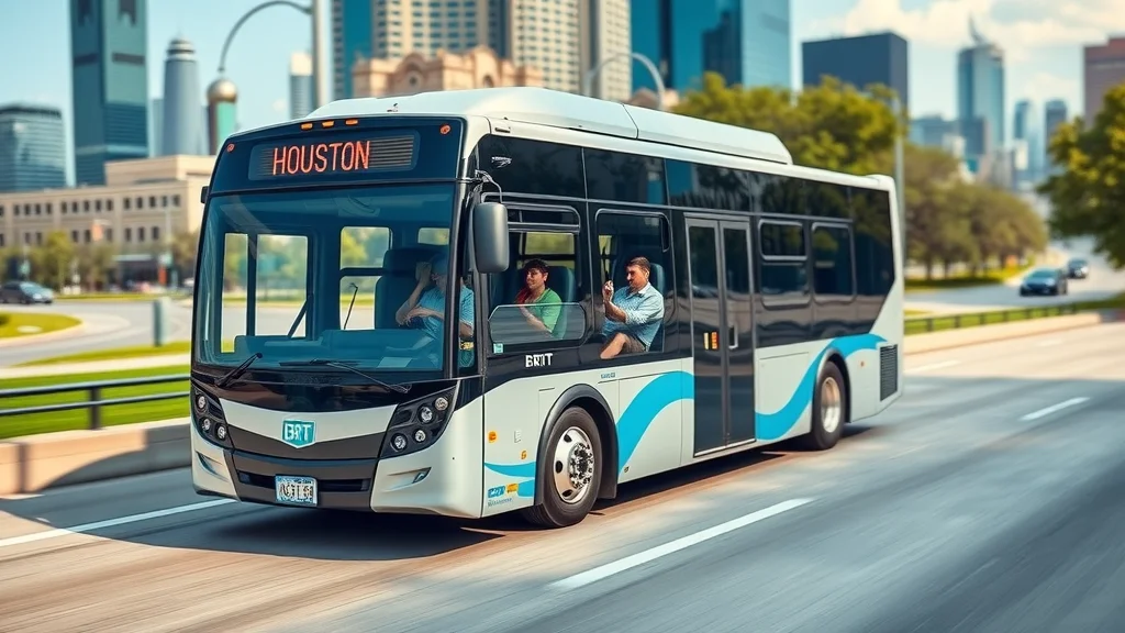
Bus rapid transit (BRT) has become a game-changer for houston public transportation, promising faster speeds, consistent schedules, and improved rider experience. Unlike regular bus lines, BRT operates on dedicated lanes, offers fewer stops, and uses specialized buses able to accommodate large crowds. Houston’s first major BRT project—the Silver Line—serves the bustling Post Oak corridor, providing a vital north-south link through Uptown and the Galleria.
The launch of these new routes has demonstrated how bus rapid solutions can rival some benefits of light rail, at lower cost and with greater flexibility. Features like level boarding, real-time tracking, traffic signal priority, and limited interference from car traffic translate into higher reliability for commuters, encouraging more people to leave their cars at home.
Rapid transit initiatives: Efficiency, challenges, and expansion
Mounting support—and a forward-thinking billion bond—means houston public transportation is pushing ahead with expanded rapid transit lines in key growth corridors. Plans include new BRT and bus rapid transit lines to Hobby Airport and the University of Houston, improvements to Park & Ride, and upgrades to existing high-frequency routes that serve job centers in greater Houston.
Despite the promise, challenges persist. Constructing dedicated busways requires significant investment and careful integration with current infrastructure, while keeping service consistent during expansion phases. As these initiatives unfold, Houston stands to gain a more efficient, user-friendly system that can scale with population and economic growth. The combined effect: better connections, fewer gridlock headaches, and a city better poised for the future.
Houston’s Rail System: Connecting Communities
How the METRORail rail system fits into Houston public transportation
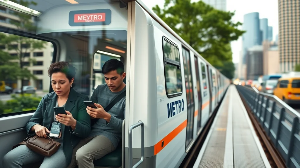
The METRORail is Houston’s light rail system, offering a fast and frequent travel option through key urban corridors. Comprising three main rail lines—Red, Green, and Purple—the METRORail links downtown Houston to NRG Park, the Texas Medical Center, the Museum District, and emerging neighborhoods east and southeast of downtown. Each train offers accessible boarding, climate control, and mobile ticketing, supporting commuters and visitors alike.
The rail system eases pressure on busy arterial roadways, provides a reliable option during major city events (like those at NRG Park), and helps connect the dots between other forms of public transportation in Houston. With frequent departures—every 6–15 minutes depending on the time of day—METRORail underpins the city’s vision of integrated transportation.
Rail system expansion: What’s next for Houston public transportation?
Future growth of the rail system centers on new routes, corridor upgrades, and improved connectivity with bus rapid transit. Planned expansions under the METRONext plan include extending the Green and Purple lines to Hobby Airport and launching new rapid transit corridors to connect expanding employment and education hubs.
These investments aim to make the Houston public transportation network even more competitive, increase ridership, and reduce the region’s notorious traffic congestion. Expansion of the light rail will connect more neighborhoods, enhance real estate value, and advance Houston’s journey towards a truly multimodal metro area.
Bus System and Rider Experience in Houston Public Transportation
Exploring Houston’s bus system routes and coverage
Houston’s bus system is one of the most expansive in the region, covering the entirety of the METRO service area and making the network pivotal for residents who don’t have access to rail. More than 90 bus routes operate daily, including high-frequency local buses crisscrossing downtown Houston, north-south cross-town services, park & ride lines, and unique circulator systems.
For those living farther out, park & ride express buses offer a valuable option, with amenities such as Wi-Fi, air conditioning, and comfortable seating. In neighborhoods like Midtown, Montrose, and East End, walkable access to bus stops and a wide choice of services make car-free living a credible choice. METRO’s digital tools—real-time tracking, open data, and mobile trip planners—help riders stay informed, while bus stop upgrades provide better shelter, security, and seating.
Bus system improvements: Reliability, safety, and comfort
Over the last decade, METRO has prioritized bus system enhancements—reducing travel times, increasing reliability, and responding to rider feedback. Upgraded vehicles feature cleaner interiors, low-floor boarding, digital screens, and improved climate control. Major bus route redesigns, such as the 2015 New Bus Network, reorganized lines for more straight-shot, frequent, and timely service, directly addressing the needs of a sprawling city.
Complemented by coordinated efforts with metro police for onboard and station safety, and pilots for all-door boarding, METRO continues to enhance public trust and comfort. Incremental improvements—like quieter buses, digital wayfinding, and expanded accessibility—make it easier for Houstonians to leave the car behind and confidently rely on transit as part of their daily lives.
How to Pay for Houston Public Transportation: Fares and Options
Fare structures, payment methods, and discount options
Affordability and flexibility are two critical strengths of houston public transportation. Fares are straightforward: a standard local bus or rail line ride costs $1.25, with free transfers for up to three hours between bus and rail. Park & Ride express bus services have distance-based fares ranging from $2–$4.50. Riders can pay with cash, reloadable METRO Q® Fare Cards, the METRO Q Mobile Ticketing app, or discounted passes available at transit centers, online, and select retailers.
Students (K–college), seniors, Medicare cardholders, and people with disabilities enjoy discounted and even free fares, making inclusivity a shallow barrier. Additionally, special monthly and day pass options help frequent riders save, while corporate and university partnerships (including the University of Houston) offer further discounts for large employee and student populations.
Ticket Types, Prices, and Where to Purchase for Houston Public Transportation |
||
Ticket Type |
Price |
Where to Buy |
|---|---|---|
Local Bus / Light Rail Single Ride |
$1.25 |
Onboard bus (cash), Fare Vending Machines, METRO Q Card, Q Mobile App |
METRO Day Pass |
$3.00 |
Q Card, Q Mobile App, Retail Stores |
Park & Ride Fare |
$2.00–$4.50 |
Fare Vending Machines, Q Card, Online Portal |
Senior/Student/Medicare Discount |
50% Off Standard Fare |
METRO RideStore, Online Application, Partner Institutions |
METRO 30-Day Pass |
$45.00 |
Q Card, Online, METRO RideStore |
Houston Public Transportation Safety: METRO Police and Rider Protection

The role of METRO police in public transportation
Safety is a fundamental pillar of houston public transportation, and the METRO police department plays a central role. Specially trained officers patrol buses, trains, and transit centers, provide rapid response to incidents, and work proactively to deter crime in the system’s service area.
METRO police also collaborate with local law enforcement and utilize modern surveillance, public address systems, and community engagement programs to protect both property and passengers. Their visible presence—uniformed and approachable—creates a reassuring environment, making public transit safe for riders of all backgrounds.
Safety tips for using Houston public transportation
Always be aware of your surroundings and keep personal belongings close
Use well-lit bus stops and transit centers, particularly at night
Report any suspicious behavior directly to METRO police or transit staff
Plan your route in advance and keep your METRO Q Card or fare handy
Trust your instincts—if something feels off, switch cars or alert security
By following these guidelines and leveraging METRO’s safety resources, riders can maximize their confidence and comfort throughout the houston public transportation network.
Ride Circuit and Other Innovative Transit Options in Houston
Is Ride Circuit free and who should use it?
Ride Circuit is Houston’s innovative electric shuttle service, providing free rides within designated downtown zones. The service uses zero-emission vehicles that operate on a scheduled route or via a mobile app, making it exceptionally convenient for quick downtown trips, lunch runs, or events in the Theater District or near major offices.
This option is ideal for tourists, office workers, and residents who want quick, eco-friendly rides for short distances—reducing the dependency on private cars and integrating smoothly with Houston public transportation.
Alternative mobility: Microtransit, e-scooters, and bike share
To complement the major public transit system, Houston has rolled out flexible, tech-driven solutions for first-mile/last-mile and short-hop travel. Dockless e-scooters, BCycle bike share, and pilot microtransit programs fill gaps where fixed-route transit can’t easily reach.
These innovative options are vital for linking neighborhoods to primary bus routes and transit lines, as well as serving special events or large campuses. For example, after arriving at a transit center, you might take an e-scooter to reach a restaurant, festival, or your final destination blocks away. As Houston continues to innovate, residents benefit from a more versatile and responsive mobility landscape.

People Also Ask: Houston Public Transportation FAQs
Does Houston have a public transportation system?
Absolutely. Houston has a comprehensive public transportation system operated primarily by METRO, including bus, rail system, bus rapid transit, park & ride routes, and special access services.
Can I get around Houston without a car?
While Houston is famous for car culture, it’s entirely possible to navigate many areas using Houston public transportation, supplemented by microtransit, bike share, e-scooters, and rideshare options.
How do you pay for public transport in Houston?
Houston public transportation fares can be paid with reloadable METRO Q® Fare Cards, the METRO Q Mobile Ticketing app, cash onboard, or discounted passes at ticket vending machines and online portals.
Is Ride Circuit free in Houston?
Yes! Ride Circuit operates free electric shuttles in select downtown zones, making short trips within those boundaries accessible at no charge.
My Opinion: Strengths and Weaknesses of Houston Public Transportation
For daily commuters, Houston public transportation offers reliability and affordability, but expansion and frequency remain key areas for concern.
In my experience, Houston public transportation is a work in progress. Strengths include clean, well-maintained buses and trains, courteous staff, and affordable fares. Weaknesses revolve around lower service frequency during off-peak hours, limited late-night options, and the ongoing need for more inclusive coverage, particularly in further suburbs. As new investments roll in, I’m optimistic Houston will close these gaps and become a model for smart, sustainable mobility.
How Houston Public Transportation Can Improve: A Vision for the Future
Expansion of late-night and weekend services
Investment in bus rapid and rail system innovations
More user-focused digital wayfinding tools
Policies for accessibility and inclusion
The future of Houston public transportation depends on city leaders, METRO, and the public working together to expand access, embrace technology, and build a true city-wide culture of transit.
Key Takeaways on Houston Public Transportation
Houston public transportation is robust yet underutilized
Multiple options beyond just the bus system and rail system
Payment is flexible and increasingly digital
Safety is ensured by visible METRO police
Ride Circuit and innovative transit complement traditional options
FAQs: Houston Public Transportation Quick Answers
What is the best way to plan a journey using Houston public transportation?
The best way to plan is by using the METRO Trip Planner app or website. Enter your start and end points, review suggested routes and schedules, and check real-time arrivals to optimize your trip.
Are there discounts for students and seniors on Houston public transportation?
Yes, students, seniors, and people with disabilities can access significant discounts, often 50% off or more, by applying online or at METRO RideStores. Ensure you bring qualifying ID for reduced fare programs.
What should newcomers know about the Houston public transportation culture?
Houstonians value courtesy and patience on public transit. Expect friendly drivers, helpful signage, and a mix of daily commuters and casual riders. Using digital apps and Q Cards will make your experience smoother.
Conclusion
Houston public transportation is evolving—embrace its opportunities, stay informed, and be part of a city on the move.
As you continue to explore Houston’s dynamic transit landscape, consider how broader citywide challenges—like traffic congestion and infrastructure resilience—shape the daily experience for riders. Gaining this perspective can help you make more informed decisions about your commute and appreciate the ongoing efforts to create a more connected, accessible city for everyone.
To further broaden your understanding of navigating life in Houston using public transit, the resource Living in Houston: What to Know offers a detailed guide on the city's unique neighborhoods, amenities, and essential insider tips for residents and newcomers alike. This article deepens your perspective on how public transportation fits into everyday life and what you can expect when relocating or moving around Houston. If you’re serious about mastering Houston public transportation, these resources will give you the practical context and local insights you need for seamless city living.


Write A Comment